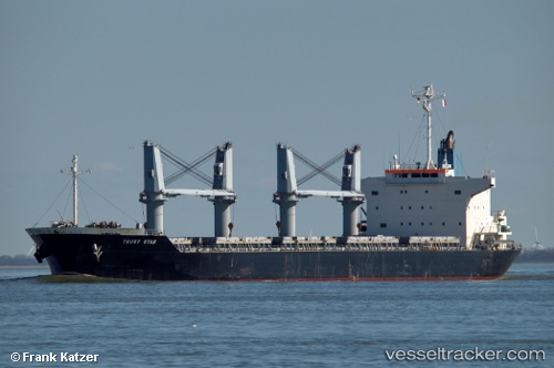
 TRUST STAR
Current Status
Where is the vessel?
TRUST STAR is currently in 383 nm SW of Benahavis, based on AIS data received about 14h ago.
Latest AIS update:
Current position: 33.16821° N, 57.12051° W (383 nm SW of Benahavis)
Average speed (last 7 days): Loading…
Average speed (last 30 days): Loading…
Vessel profile: TRUST STAR is a Bulk Carrier with dimensions m x m.
This page combines live AIS, route history, probable destination signals, nearby traffic, and port activity for practical vessel monitoring.
The current position of vessel TRUST STAR is 33.16821 lat / -57.12051 lng. Updated: 2026-05-19 15:48:15 UTCNearest reference points:
- Open sea, approx. 401 nm off the nearest listed port
- Open sea, approx. 403 nm off the nearest listed port
- Open sea, approx. 406 nm off the nearest listed port
Currently sailing under the flag of Malta ![]()
Details:
Live Vessel TRUST STAR Analytics (details, animations, etc.)
Recent AIS points (UTC):
2026-05-19 12:15:54 UTC · 33.22121, -57.11102 · SOG 0.5 kn · COG 5°2026-05-19 13:39:28 UTC · 33.19830, -57.11318 · SOG 1.3 kn · COG 68°
2026-05-19 13:52:27 UTC · 33.19467, -57.11407 · SOG 1.2 kn · COG 71°
2026-05-19 15:48:15 UTC · 33.16821, -57.12051 · SOG 1.1 kn · COG 77°