 vesseltracker.com
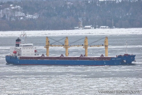
 SAFEEN AL NASR
Current Status
Where is the vessel?
SAFEEN AL NASR is currently in Near KRIMPEN, based on AIS data received about 7d ago.
Latest AIS update:
Current position: 51.90583° N, 4.56738° E (Near KRIMPEN)
Average speed (last 7 days): Loading…
Average speed (last 30 days): Loading…
Vessel profile: SAFEEN AL NASR is a Bulk Carrier with dimensions m x m.
This page combines live AIS, route history, probable destination signals, nearby traffic, and port activity for practical vessel monitoring.
The current position of vessel SAFEEN AL NASR is 51.90583 lat / 4.56738 lng. Updated: 2026-05-11 20:45:04 UTCNearest reference points:
- Near KRIMPEN
- Near ROTTERDAM CENTRUM
- Near Puttershoek
Currently sailing under the flag of Marshall Islands ![]()
Details:
Live Vessel SAFEEN AL NASR Analytics (details, animations, etc.)
Recent AIS points (UTC):
2026-05-11 20:45:04 UTC · 51.90583, 4.56738 · SOG 0 kn · COG 283°2026-05-11 20:45:04 UTC · 51.90583, 4.56738 · SOG 0 kn · COG 283°
2026-05-11 20:45:04 UTC · 51.90583, 4.56738 · SOG 0 kn · COG 283°
2026-05-11 20:45:04 UTC · 51.90583, 4.56738 · SOG 0 kn · COG 283°