 FEDERICA
Current Status
Where is the vessel?
FEDERICA is currently in Near Kumport, based on AIS data received about 14h ago.
Latest AIS update:
Current position: 40.93131° N, 28.84514° E (Near Kumport)
Average speed (last 7 days): Loading…
Average speed (last 30 days): Loading…
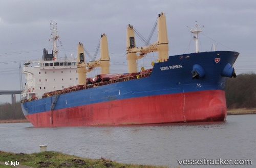
Vessel profile: FEDERICA is a Bulk Carrier with dimensions m x m.
This page combines live AIS, route history, probable destination signals, nearby traffic, and port activity for practical vessel monitoring.
The current position of vessel FEDERICA is 40.93131 lat / 28.84514 lng. Updated: 2026-05-22 23:54:03 UTCNearest reference points:
- Near BAKIRKOY
- Near ZEYTINBURNU
- Near Kumport
Currently sailing under the flag of Marshall Islands ![]()
Details:
Live Vessel FEDERICA Analytics (details, animations, etc.)
Recent AIS points (UTC):
2026-05-22 20:00:11 UTC · 40.93168, 28.84423 · SOG 0 kn · COG 36°2026-05-22 21:32:53 UTC · 40.93147, 28.84475 · SOG 0 kn · COG 21°
2026-05-22 22:05:49 UTC · 40.93128, 28.84524 · SOG 0 kn · COG 6°
2026-05-22 23:54:03 UTC · 40.93131, 28.84514 · SOG 0 kn · COG 7°