 vesseltracker.com
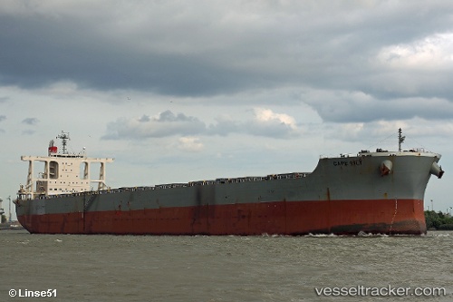
 Cape Lily
Current Status
Where is the vessel?
Cape Lily is currently in 89 nm SE of HAMAJIMA, based on AIS data received about 14h ago.
Latest AIS update:
Current position: 32.95701° N, 137.50780° E (89 nm SE of HAMAJIMA)
Average speed (last 7 days): Loading…
Average speed (last 30 days): Loading…
Vessel profile: Cape Lily is a Bulk Carrier with dimensions 292m x 45m.
This page combines live AIS, route history, probable destination signals, nearby traffic, and port activity for practical vessel monitoring.
The current position of vessel Cape Lily is 32.95701 lat / 137.50780 lng. Updated: 2026-05-18 01:42:03 UTCNearest reference points:
- 133 nm S of OMAEZAKI
- 88 nm SE of Minachi
- 20 nm S of HAMAJIMA
Currently sailing under the flag of Singapore ![]()
Details:
Live Vessel Cape Lily Analytics (details, animations, etc.)
Recent AIS points (UTC):
2026-05-17 23:01:41 UTC · 32.95244, 137.41425 · SOG 1.7 kn · COG 183°2026-05-17 23:43:53 UTC · 32.95404, 137.43864 · SOG 2 kn · COG 177°
2026-05-18 01:40:52 UTC · 32.95698, 137.50714 · SOG 1.9 kn · COG 178°
2026-05-18 01:42:03 UTC · 32.95701, 137.50780 · SOG 1.6 kn · COG 179°