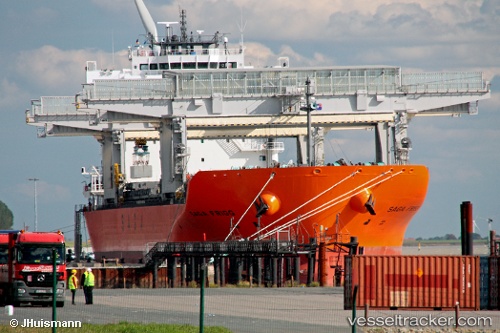
 SAGA FRIGG
Current Status
Where is the vessel?
SAGA FRIGG is currently in 24 nm S of Eastbourne, based on AIS data received about 15h ago.
Latest AIS update:
Current position: 50.37173° N, 0.21528° E (24 nm S of Eastbourne)
Average speed (last 7 days): Loading…
Average speed (last 30 days): Loading…
Vessel profile: SAGA FRIGG is a Cargo/Container Ship with dimensions m x m.
This page combines live AIS, route history, probable destination signals, nearby traffic, and port activity for practical vessel monitoring.
The current position of vessel SAGA FRIGG is 50.37173 lat / 0.21528 lng. Updated: 2026-05-19 00:06:19 UTCNearest reference points:
- 27 nm S of Seaford
- 23 nm S of Poling
- Near Saint Leonards-on-Sea
Currently sailing under the flag of Bahamas ![]()
Details:
Live Vessel SAGA FRIGG Analytics (details, animations, etc.)
Recent AIS points (UTC):
2026-05-18 20:01:29 UTC · 50.11194, -1.22726 · SOG 14.6 kn · COG 72°2026-05-18 21:27:41 UTC · 50.20453, -0.68842 · SOG 14.7 kn · COG 71°
2026-05-18 23:10:38 UTC · 50.31773, -0.08131 · SOG 13.2 kn · COG 75°
2026-05-19 00:06:19 UTC · 50.37173, 0.21528 · SOG 12.2 kn · COG 74°