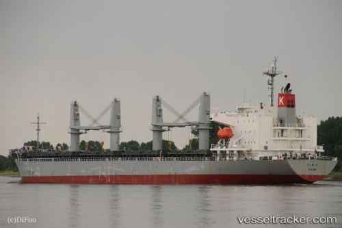
Elm K
Current StatusWhere is the vessel?
Elm K is currently in 62 nm S of Lenard Harbour, based on AIS data received about 16h ago.
Latest AIS update:
Current position: 54.08593° N, 162.23248° W (62 nm S of Lenard Harbour)
Average speed (last 7 days): Loading…
Average speed (last 30 days): Loading…
Vessel profile: Elm K is a General Cargo Ship with dimensions 28m x 181m.
This page combines live AIS, route history, probable destination signals, nearby traffic, and port activity for practical vessel monitoring.
The current position of vessel Elm K is 54.08593 lat / -162.23248 lng. Updated: 2026-05-20 01:31:03 UTCNearest reference points:
- Near Lenard Harbour
Details:
Live Vessel Elm K Analytics (details, animations, etc.)
Recent AIS points (UTC):
2026-05-19 22:06:54 UTC · 53.96712, -161.12477 · SOG 11.8 kn · COG 285°2026-05-19 23:35:57 UTC · 54.02042, -161.61124 · SOG 12.1 kn · COG 279°
2026-05-20 01:01:11 UTC · 54.07138, -162.07635 · SOG 11.7 kn · COG 275°
2026-05-20 01:31:03 UTC · 54.08593, -162.23248 · SOG 11.3 kn · COG 274°