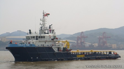
Tablate Tide
Current StatusWhere is the vessel?
Tablate Tide is currently in 14 nm N of Ras Al Khair, based on AIS data received about 15h ago.
Latest AIS update:
Current position: 27.77304° N, 49.24128° E (14 nm N of Ras Al Khair)
Average speed (last 7 days): Loading…
Average speed (last 30 days): Loading…
Vessel profile: Tablate Tide is a Offshore Tug Supply Ship with dimensions 14m x 59m.
This page combines live AIS, route history, probable destination signals, nearby traffic, and port activity for practical vessel monitoring.
The current position of vessel Tablate Tide is 27.77304 lat / 49.24128 lng. Updated: 2026-05-21 04:13:13 UTCNearest reference points:
- Near Ras Al Khair
- Near Ras Al-Khair
- 29 nm E of Bandar Al Mishab
Details:
Live Vessel Tablate Tide Analytics (details, animations, etc.)
Recent AIS points (UTC):
2026-05-21 01:24:42 UTC · 27.77890, 48.87425 · SOG 0 kn · COG 327°2026-05-21 01:39:33 UTC · 27.78320, 48.88955 · SOG 7.8 kn · COG 89°
2026-05-21 03:54:23 UTC · 27.75847, 49.20093 · SOG 7.9 kn · COG 82°
2026-05-21 04:13:13 UTC · 27.77304, 49.24128 · SOG 8 kn · COG 37°