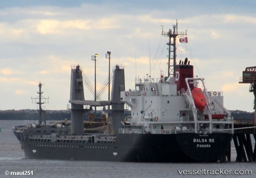
 Balsa 92
Current Status
Where is the vessel?
Balsa 92 is currently in Near Hampton Roads, based on AIS data received about 14h ago.
Latest AIS update:
Current position: 36.94122° N, 76.37846° W (Near Hampton Roads)
Average speed (last 7 days): Loading…
Average speed (last 30 days): Loading…
Vessel profile: Balsa 92 is a General Cargo Ship with dimensions 106m x 106m.
This page combines live AIS, route history, probable destination signals, nearby traffic, and port activity for practical vessel monitoring.
The current position of vessel Balsa 92 is 36.94122 lat / -76.37846 lng. Updated: 2026-05-21 13:57:22 UTCNearest reference points:
- Near Newport News
- Near Sewell's Point
- Near Hampton Roads Pt
Currently sailing under the flag of Panama ![]()
Balsa 92 built in 2013 year
Deadweight:
7733 tDetails:
Live Vessel Balsa 92 Analytics (details, animations, etc.)
Recent AIS points (UTC):
2026-05-21 10:42:21 UTC · 36.94088, -76.37803 · SOG 0 kn · COG 239°2026-05-21 12:00:21 UTC · 36.94087, -76.37804 · SOG 0 kn · COG 242°
2026-05-21 13:39:23 UTC · 36.94115, -76.37826 · SOG 0.1 kn · COG 226°
2026-05-21 13:57:22 UTC · 36.94122, -76.37846 · SOG 0 kn · COG 215°