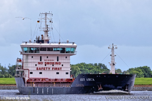
 ARIF AMCA
Current Status
Where is the vessel?
ARIF AMCA is currently in Near CARTEYA GUADARRANQUE, based on AIS data received about 15h ago.
Latest AIS update:
Current position: 36.17047° N, 5.39903° W (Near CARTEYA GUADARRANQUE)
Average speed (last 7 days): Loading…
Average speed (last 30 days): Loading…
Vessel profile: ARIF AMCA is a General Cargo with dimensions m x m.
This page combines live AIS, route history, probable destination signals, nearby traffic, and port activity for practical vessel monitoring.
The current position of vessel ARIF AMCA is 36.17047 lat / -5.39903 lng. Updated: 2026-05-20 13:39:28 UTCNearest reference points:
- Near Palmones
- Near La Línea de la Concepción
- Near Waterport
Currently sailing under the flag of Saint Kitts and Nevis ![]()
Details:
Live Vessel ARIF AMCA Analytics (details, animations, etc.)
Recent AIS points (UTC):
2026-05-20 10:33:26 UTC · 36.17206, -5.39876 · SOG 0 kn · COG 115°2026-05-20 11:36:30 UTC · 36.17191, -5.39872 · SOG 0 kn · COG 102°
2026-05-20 13:21:26 UTC · 36.17136, -5.39928 · SOG 0 kn · COG 91°
2026-05-20 13:39:28 UTC · 36.17047, -5.39903 · SOG 0.5 kn · COG 57°