 NIRIIS
Current Status
Where is the vessel?
NIRIIS is currently in 37 nm S of Sciacca, based on AIS data received about 15h ago.
Latest AIS update:
Current position: 36.95102° N, 12.75799° E (37 nm S of Sciacca)
Average speed (last 7 days): Loading…
Average speed (last 30 days): Loading…
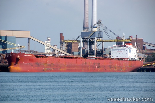
Vessel profile: NIRIIS is a Bulk Carrier with dimensions m x m.
This page combines live AIS, route history, probable destination signals, nearby traffic, and port activity for practical vessel monitoring.
The current position of vessel NIRIIS is 36.95102 lat / 12.75799 lng. Updated: 2026-05-23 07:58:43 UTCNearest reference points:
- Near MARSALA
- Near Licata
- Near Trapani
Currently sailing under the flag of Marshall Islands ![]()
Details:
Live Vessel NIRIIS Analytics (details, animations, etc.)
Recent AIS points (UTC):
2026-05-23 04:22:13 UTC · 36.59293, 13.58436 · SOG 13.1 kn · COG 299°2026-05-23 05:21:54 UTC · 36.70678, 13.36145 · SOG 12.5 kn · COG 296°
2026-05-23 07:43:12 UTC · 36.92746, 12.81600 · SOG 12 kn · COG 298°
2026-05-23 07:58:43 UTC · 36.95102, 12.75799 · SOG 11.9 kn · COG 297°