 KUBRAT
Current Status
Where is the vessel?
KUBRAT is currently in 136 nm W of Tinaquillo, based on AIS data received about 14h ago.
Latest AIS update:
Current position: 10.52687° N, 66.08424° E (136 nm W of Tinaquillo)
Average speed (last 7 days): Loading…
Average speed (last 30 days): Loading…
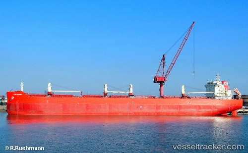
Vessel profile: KUBRAT is a Bulk Carrier with dimensions m x m.
This page combines live AIS, route history, probable destination signals, nearby traffic, and port activity for practical vessel monitoring.
The current position of vessel KUBRAT is 10.52687 lat / 66.08424 lng. Updated: 2026-05-22 19:27:59 UTCNearest reference points:
- 187 nm N of Tinaquillo
- 98 nm S of Tinaquillo
Currently sailing under the flag of Marshall Islands ![]()
Details:
Live Vessel KUBRAT Analytics (details, animations, etc.)
Recent AIS points (UTC):
2026-05-22 16:50:10 UTC · 10.64548, 65.65376 · SOG 10 kn · COG 113°2026-05-22 17:35:21 UTC · 10.60890, 65.77949 · SOG 10.3 kn · COG 105°
2026-05-22 19:18:15 UTC · 10.52933, 66.06553 · SOG 10.2 kn · COG 100°
2026-05-22 19:27:59 UTC · 10.52687, 66.08424 · SOG 10.1 kn · COG -1°