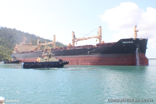
 STAR PEGASUS
Current Status
Where is the vessel?
STAR PEGASUS is currently in 36 nm W of Huaral, based on AIS data received about 14h ago.
Latest AIS update:
Current position: 11.61846° S, 77.78951° W (36 nm W of Huaral)
Average speed (last 7 days): Loading…
Average speed (last 30 days): Loading…
Vessel profile: STAR PEGASUS is a Bulk Carrier with dimensions m x m.
This page combines live AIS, route history, probable destination signals, nearby traffic, and port activity for practical vessel monitoring.
The current position of vessel STAR PEGASUS is -11.61846 lat / -77.78951 lng. Updated: 2026-05-19 08:04:17 UTCNearest reference points:
- Near Callao
- 43 nm SW of Barranca
- 125 nm SW of Supe Bay
Currently sailing under the flag of Liberia ![]()
Details:
Live Vessel STAR PEGASUS Analytics (details, animations, etc.)
Recent AIS points (UTC):
2026-05-19 04:37:56 UTC · -11.99319, -77.25832 · SOG 9.9 kn · COG 299°2026-05-19 06:21:06 UTC · -11.80550, -77.52627 · SOG 11.4 kn · COG 308°
2026-05-19 07:15:47 UTC · -11.70457, -77.66732 · SOG 11 kn · COG 307°
2026-05-19 08:04:17 UTC · -11.61846, -77.78951 · SOG 10.9 kn · COG 308°