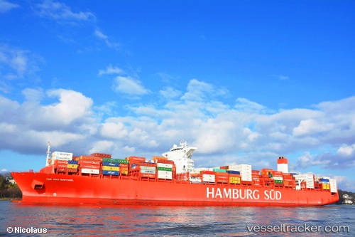
 Cap San Raphael
Current Status
Where is the vessel?
Cap San Raphael is currently in 25 nm NW of ALDERNEY, based on AIS data received about 14h ago.
Latest AIS update:
Current position: 50.07296° N, 2.54230° W (25 nm NW of ALDERNEY)
Average speed (last 7 days): Loading…
Average speed (last 30 days): Loading…
Vessel profile: Cap San Raphael is a Container Ship with dimensions 333m x 48m.
This page combines live AIS, route history, probable destination signals, nearby traffic, and port activity for practical vessel monitoring.
The current position of vessel Cap San Raphael is 50.07296 lat / -2.54230 lng. Updated: 2026-05-19 03:46:53 UTCNearest reference points:
- 23 nm NW of Saint Sampson
- Near ALDERNEY
- Near Castletown
Currently sailing under the flag of Denmark ![]()
Cap San Raphael built in 2014 year
Deadweight:
124460 tDetails:
Live Vessel Cap San Raphael Analytics (details, animations, etc.)
Recent AIS points (UTC):
2026-05-18 23:59:22 UTC · 50.30134, -1.16507 · SOG 12 kn · COG 254°2026-05-19 01:29:52 UTC · 50.22576, -1.67805 · SOG 14.4 kn · COG 250°
2026-05-19 01:32:41 UTC · 50.22284, -1.69505 · SOG 14.5 kn · COG 249°
2026-05-19 03:46:53 UTC · 50.07296, -2.54230 · SOG 14.4 kn · COG 248°