 KRAIT
KRAIT
Current Status
Where is the vessel?
KRAIT is currently in 35 nm NE of Wainibe, based on AIS data received about 15h ago.
Latest AIS update:
Current position: 2.58526° S, 126.86050° E (35 nm NE of Wainibe)
Average speed (last 7 days): Loading…
Average speed (last 30 days): Loading…
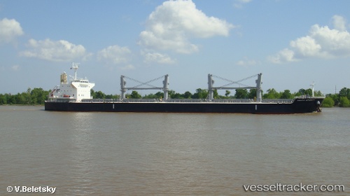
Vessel profile: KRAIT is a Cargo with dimensions m x m.
This page combines live AIS, route history, probable destination signals, nearby traffic, and port activity for practical vessel monitoring.
The current position of vessel KRAIT is -2.58526 lat / 126.86050 lng. Updated: 2026-05-21 17:05:34 UTCNearest reference points:
- 69 nm NW of Wainibe
- 55 nm S of Labuha, Molucas
- Near Ambon
Currently sailing under the flag of Marshall Islands ![]()
Details:
Live Vessel KRAIT Analytics (details, animations, etc.)
Recent AIS points (UTC):
2026-05-21 12:22:40 UTC · -2.26470, 127.61122 · SOG 10.9 kn · COG 241°2026-05-21 12:22:40 UTC · -2.26470, 127.61122 · SOG 10.9 kn · COG 241°
2026-05-21 15:55:28 UTC · -2.50533, 127.04116 · SOG 9.8 kn · COG -1°
2026-05-21 17:05:34 UTC · -2.58526, 126.86050 · SOG 10.8 kn · COG -1°