 SUPRA PASHA
Current Status
Where is the vessel?
SUPRA PASHA is currently in 160 nm W of Sandys, based on AIS data received about 15h ago.
Latest AIS update:
Current position: 31.79935° N, 67.96479° W (160 nm W of Sandys)
Average speed (last 7 days): Loading…
Average speed (last 30 days): Loading…
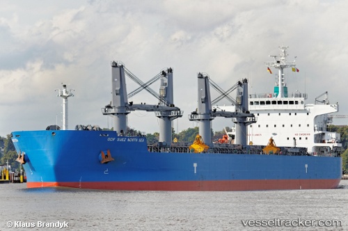
Vessel profile: SUPRA PASHA is a Bulk Carrier with dimensions m x m.
This page combines live AIS, route history, probable destination signals, nearby traffic, and port activity for practical vessel monitoring.
The current position of vessel SUPRA PASHA is 31.79935 lat / -67.96479 lng. Updated: 2026-05-18 19:31:58 UTCNearest reference points:
- 160 nm W of Sandys
- 150 nm S of Ben Slimane
Currently sailing under the flag of Liberia ![]()
Details:
Live Vessel SUPRA PASHA Analytics (details, animations, etc.)
Recent AIS points (UTC):
2026-05-18 16:56:56 UTC · 31.56090, -68.48702 · SOG 11.8 kn · COG 61°2026-05-18 16:56:56 UTC · 31.56090, -68.48702 · SOG 11.8 kn · COG 61°
2026-05-18 19:17:56 UTC · 31.77922, -68.01318 · SOG 11.8 kn · COG 66°
2026-05-18 19:31:58 UTC · 31.79935, -67.96479 · SOG 11.7 kn · COG 66°