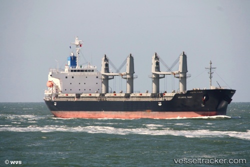
 Atlantic Ruby
Current Status
Where is the vessel?
Atlantic Ruby is currently in Near Agigea, based on AIS data received about 15h ago.
Latest AIS update:
Current position: 44.10832° N, 28.65455° E (Near Agigea)
Average speed (last 7 days): Loading…
Average speed (last 30 days): Loading…
Vessel profile: Atlantic Ruby is a Bulk Carrier with dimensions 180m x 29m.
This page combines live AIS, route history, probable destination signals, nearby traffic, and port activity for practical vessel monitoring.
The current position of vessel Atlantic Ruby is 44.10832 lat / 28.65455 lng. Updated: 2026-05-19 23:40:53 UTCNearest reference points:
- Near Constanta
- Near Ovidiu
- Near MIDIA
Currently sailing under the flag of Panama ![]()
Atlantic Ruby built in 2012 year
Deadweight:
33680 tDetails:
Live Vessel Atlantic Ruby Analytics (details, animations, etc.)
Recent AIS points (UTC):
2026-05-19 20:09:21 UTC · 44.10832, 28.65457 · SOG 0 kn · COG 270°2026-05-19 21:58:53 UTC · 44.10834, 28.65459 · SOG 0.1 kn · COG 271°
2026-05-19 22:31:53 UTC · 44.10832, 28.65458 · SOG 0 kn · COG 270°
2026-05-19 23:40:53 UTC · 44.10832, 28.65455 · SOG 0 kn · COG 271°