 AMIRANTE
Current Status
Where is the vessel?
AMIRANTE is currently in Near Pernis, based on AIS data received about 15h ago.
Latest AIS update:
Current position: 51.88804° N, 4.36921° E (Near Pernis)
Average speed (last 7 days): Loading…
Average speed (last 30 days): Loading…
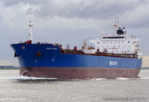
Vessel profile: AMIRANTE is a Oil/Chemical Tanker with dimensions m x m.
This page combines live AIS, route history, probable destination signals, nearby traffic, and port activity for practical vessel monitoring.
The current position of vessel AMIRANTE is 51.88804 lat / 4.36921 lng. Updated: 2026-05-20 06:04:29 UTCNearest reference points:
- Near Pernis
- Near VONDELINGENPLAAT - ROTTERDAM
- Near ROTTERDAM PERNIS
Currently sailing under the flag of Marshall Islands ![]()
Details:
Live Vessel AMIRANTE Analytics (details, animations, etc.)
Recent AIS points (UTC):
2026-05-20 02:07:31 UTC · 51.88803, 4.36924 · SOG 0 kn · COG 285°2026-05-20 04:07:29 UTC · 51.88806, 4.36919 · SOG 0 kn · COG 285°
2026-05-20 04:40:34 UTC · 51.88806, 4.36921 · SOG 0 kn · COG 285°
2026-05-20 06:04:29 UTC · 51.88804, 4.36921 · SOG 0 kn · COG 285°