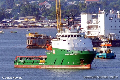
 SEAHORSE SYNERGY
Current Status
Where is the vessel?
SEAHORSE SYNERGY is currently in 32 nm NW of Bach Ho, based on AIS data received about 14h ago.
Latest AIS update:
Current position: 10.28330° N, 107.72101° E (32 nm NW of Bach Ho)
Average speed (last 7 days): Loading…
Average speed (last 30 days): Loading…
Vessel profile: SEAHORSE SYNERGY is a Offshore Supply Ship with dimensions m x m.
This page combines live AIS, route history, probable destination signals, nearby traffic, and port activity for practical vessel monitoring.
The current position of vessel SEAHORSE SYNERGY is 10.28330 lat / 107.72101 lng. Updated: 2026-05-19 14:03:21 UTCNearest reference points:
- 30 nm NW of Bach Ho
- 15 nm SE of Bà Ria
- 12 nm SE of Cape St. Jacques
Currently sailing under the flag of Panama ![]()
Details:
Live Vessel SEAHORSE SYNERGY Analytics (details, animations, etc.)
Recent AIS points (UTC):
2026-05-19 11:14:35 UTC · 10.28564, 107.90937 · SOG 6.5 kn · COG 262°2026-05-19 11:37:32 UTC · 10.28386, 107.86693 · SOG 6.5 kn · COG 263°
2026-05-19 13:14:03 UTC · 10.27860, 107.78468 · SOG 2.7 kn · COG 239°
2026-05-19 14:03:21 UTC · 10.28330, 107.72101 · SOG 3.2 kn · COG 260°