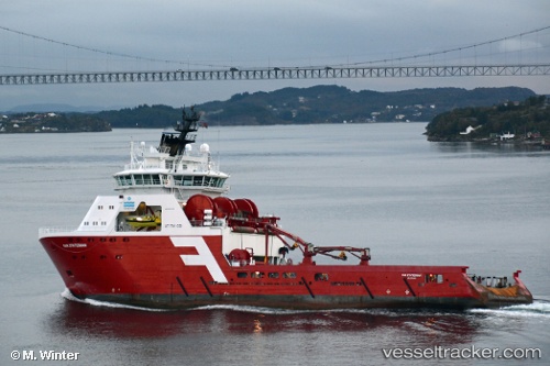
 ODIN VIKING
Current Status
Where is the vessel?
ODIN VIKING is currently in Near Damsgård, based on AIS data received about 14h ago.
Latest AIS update:
Current position: 60.38714° N, 5.31109° E (Near Damsgård)
Average speed (last 7 days): Loading…
Average speed (last 30 days): Loading…
Vessel profile: ODIN VIKING is a Anchor Handling Vessel with dimensions m x m.
This page combines live AIS, route history, probable destination signals, nearby traffic, and port activity for practical vessel monitoring.
The current position of vessel ODIN VIKING is 60.38714 lat / 5.31109 lng. Updated: 2026-05-21 13:38:41 UTCNearest reference points:
- Near Bergen
- Near Damsgård
- Near Skålevik
Currently sailing under the flag of Norway ![]()
Details:
Live Vessel ODIN VIKING Analytics (details, animations, etc.)
Recent AIS points (UTC):
2026-05-21 09:47:39 UTC · 60.38731, 5.31103 · SOG 0 kn · COG 311°2026-05-21 10:59:38 UTC · 60.38721, 5.31113 · SOG 0 kn · COG 312°
2026-05-21 11:35:33 UTC · 60.38713, 5.31105 · SOG 0 kn · COG 314°
2026-05-21 13:38:41 UTC · 60.38714, 5.31109 · SOG 0 kn · COG 313°