 ZERMATT
Current Status
Where is the vessel?
ZERMATT is currently in Near Kumport, based on AIS data received about 14h ago.
Latest AIS update:
Current position: 40.81304° N, 28.82102° E (Near Kumport)
Average speed (last 7 days): Loading…
Average speed (last 30 days): Loading…
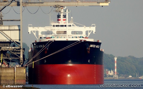
Vessel profile: ZERMATT is a Bulk Carrier with dimensions 229m x 32m.
This page combines live AIS, route history, probable destination signals, nearby traffic, and port activity for practical vessel monitoring.
The current position of vessel ZERMATT is 40.81304 lat / 28.82102 lng. Updated: 2026-05-19 01:36:26 UTCNearest reference points:
- Near Kumport
- 10 nm SE of Kumport
- 16 nm S of Kumport
Currently sailing under the flag of Marshall Islands ![]()
ZERMATT built in 2013 year
Deadweight:
82026 tDetails:
Live Vessel ZERMATT Analytics (details, animations, etc.)
Recent AIS points (UTC):
2026-05-18 22:50:05 UTC · 40.85349, 28.88487 · SOG 0.9 kn · COG 85°2026-05-18 23:34:06 UTC · 40.85086, 28.89542 · SOG 3.2 kn · COG 189°
2026-05-19 01:30:06 UTC · 40.81242, 28.82331 · SOG 0.9 kn · COG 288°
2026-05-19 01:36:26 UTC · 40.81304, 28.82102 · SOG 0.9 kn · COG 302°