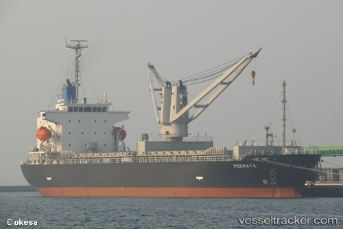
 PERMATA N
Current Status
Where is the vessel?
PERMATA N is currently in 18 nm SW of Ringhals, based on AIS data received about 14h ago.
Latest AIS update:
Current position: 57.04846° N, 11.68346° E (18 nm SW of Ringhals)
Average speed (last 7 days): Loading…
Average speed (last 30 days): Loading…
Vessel profile: PERMATA N is a General Cargo with dimensions m x m.
This page combines live AIS, route history, probable destination signals, nearby traffic, and port activity for practical vessel monitoring.
The current position of vessel PERMATA N is 57.04846 lat / 11.68346 lng. Updated: 2026-05-19 22:48:55 UTCNearest reference points:
- Near Varberg
- 11 nm SW of Vrångö
- 12 nm SW of Vrångö
Currently sailing under the flag of Barbados ![]()
Details:
Live Vessel PERMATA N Analytics (details, animations, etc.)
Recent AIS points (UTC):
2026-05-19 19:28:25 UTC · 57.58720, 11.67033 · SOG 10 kn · COG 215°2026-05-19 19:32:26 UTC · 57.57777, 11.65837 · SOG 10.5 kn · COG 214°
2026-05-19 21:40:34 UTC · 57.23168, 11.56858 · SOG 10.2 kn · COG 159°
2026-05-19 22:48:55 UTC · 57.04846, 11.68346 · SOG 9.8 kn · COG 162°