 vesseltracker.com
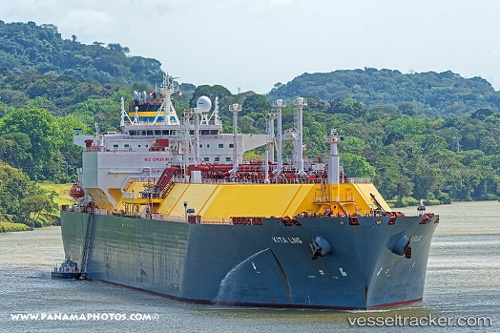
 Kita Lng
Current Status
Where is the vessel?
Kita Lng is currently in 179 nm E of MASIRAH, based on AIS data received about 1h ago.
Latest AIS update:
Current position: 20.29333° N, 62.02500° E (179 nm E of MASIRAH)
Average speed (last 7 days): Loading…
Average speed (last 30 days): Loading…
Vessel profile: Kita Lng is a Lng Tanker with dimensions 294m x 294m.
This page combines live AIS, route history, probable destination signals, nearby traffic, and port activity for practical vessel monitoring.
The current position of vessel Kita Lng is 20.29333 lat / 62.02500 lng. Updated: 2026-05-18 00:04:39 UTCNearest reference points:
- 262 nm SE of SUR
- 90 nm SE of SUR
- 224 nm E of SUR
Currently sailing under the flag of Malta ![]()
Details:
Live Vessel Kita Lng Analytics (details, animations, etc.)
Recent AIS points (UTC):
2026-05-17 19:37:07 UTC · 21.29984, 61.05946 · SOG 18.2 kn · COG 140°2026-05-17 21:25:31 UTC · 20.89417, 61.45045 · SOG 18.2 kn · COG 135°
2026-05-17 22:18:08 UTC · 20.69738, 61.64583 · SOG 18.1 kn · COG 138°
2026-05-18 00:04:39 UTC · 20.29333, 62.02500 · SOG 18 kn · COG -1°