 HYUNDAI HOPE
Current Status
Where is the vessel?
HYUNDAI HOPE is currently in 272 nm NE of Levelwood, based on AIS data received about 14h ago.
Latest AIS update:
Current position: 12.81266° S, 1.67731° W (272 nm NE of Levelwood)
Average speed (last 7 days): Loading…
Average speed (last 30 days): Loading…
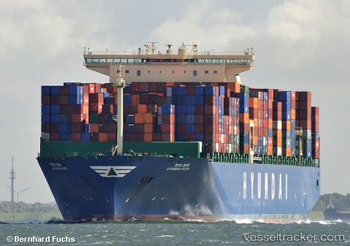
Vessel profile: HYUNDAI HOPE is a Container Ship with dimensions 48m x 366m.
This page combines live AIS, route history, probable destination signals, nearby traffic, and port activity for practical vessel monitoring.
The current position of vessel HYUNDAI HOPE is -12.81266 lat / -1.67731 lng. Updated: 2026-05-22 16:27:59 UTCNearest reference points:
- Open sea, approx. 400 nm off the nearest listed port
- Open sea, approx. 401 nm off the nearest listed port
- Open sea, approx. 402 nm off the nearest listed port
Currently sailing under the flag of Korea (Republic of) ![]()
HYUNDAI HOPE built in 2014 year
Deadweight:
145683 tDetails:
Live Vessel HYUNDAI HOPE Analytics (details, animations, etc.)
Recent AIS points (UTC):
2026-05-22 13:59:01 UTC · -12.36258, -2.01639 · SOG 13.2 kn · COG 141°2026-05-22 14:21:07 UTC · -12.42713, -1.96492 · SOG 13.2 kn · COG 141°
2026-05-22 16:15:49 UTC · -12.77357, -1.70260 · SOG 13.4 kn · COG 146°
2026-05-22 16:27:59 UTC · -12.81266, -1.67731 · SOG 13.6 kn · COG 145°