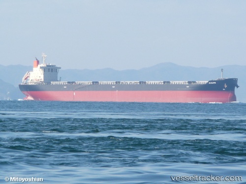
 KOULITSA 2
Current Status
Where is the vessel?
KOULITSA 2 is currently in 18 nm SW of Westport/Port Klang, based on AIS data received about 14h ago.
Latest AIS update:
Current position: 2.81472° N, 101.03124° E (18 nm SW of Westport/Port Klang)
Average speed (last 7 days): Loading…
Average speed (last 30 days): Loading…
Vessel profile: KOULITSA 2 is a Bulk Carrier with dimensions 221m x 221m.
This page combines live AIS, route history, probable destination signals, nearby traffic, and port activity for practical vessel monitoring.
The current position of vessel KOULITSA 2 is 2.81472 lat / 101.03124 lng. Updated: 2026-05-20 19:10:58 UTCNearest reference points:
- 21 nm SW of Pulau Indah
- Near Pulau Indah
- Near Westport/Port Klang
Currently sailing under the flag of Cyprus ![]()
KOULITSA 2 built in 2013 year
Deadweight:
78129 tDetails:
Live Vessel KOULITSA 2 Analytics (details, animations, etc.)
Recent AIS points (UTC):
2026-05-20 16:33:08 UTC · 2.59053, 101.47638 · SOG 10 kn · COG 300°2026-05-20 17:37:06 UTC · 2.68167, 101.30667 · SOG 11 kn · COG -1°
2026-05-20 19:10:58 UTC · 2.81472, 101.03124 · SOG 12.3 kn · COG 294°
2026-05-20 19:10:58 UTC · 2.81472, 101.03124 · SOG 12.3 kn · COG 294°