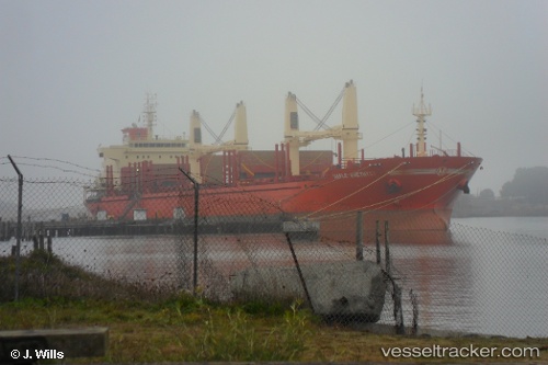
 IMPERIAL VARALAXMI
Current Status
Where is the vessel?
IMPERIAL VARALAXMI is currently in Near Nicolet, based on AIS data received about 14h ago.
Latest AIS update:
Current position: 46.28833° N, 72.58500° W (Near Nicolet)
Average speed (last 7 days): Loading…
Average speed (last 30 days): Loading…
Vessel profile: IMPERIAL VARALAXMI is a Bulk Carrier with dimensions m x m.
This page combines live AIS, route history, probable destination signals, nearby traffic, and port activity for practical vessel monitoring.
The current position of vessel IMPERIAL VARALAXMI is 46.28833 lat / -72.58500 lng. Updated: 2026-05-18 20:05:19 UTCNearest reference points:
- Near Cap-de-la-Madeleine
- Near Verchères
- Near Montréal-Est
Currently sailing under the flag of Panama ![]()
Details:
Live Vessel IMPERIAL VARALAXMI Analytics (details, animations, etc.)
Recent AIS points (UTC):
2026-05-18 16:44:19 UTC · 46.28833, -72.58500 · SOG 0 kn · COG -1°2026-05-18 17:33:01 UTC · 46.28974, -72.58648 · SOG 0 kn · COG -1°
2026-05-18 19:38:16 UTC · 46.28833, -72.58500 · SOG 0 kn · COG -1°
2026-05-18 20:05:19 UTC · 46.28833, -72.58500 · SOG 0 kn · COG -1°