 EKATERINA
Current Status
Where is the vessel?
EKATERINA is currently in 46 nm S of Santos Dumont Apt/Rio de Janeiro, based on AIS data received about 14h ago.
Latest AIS update:
Current position: 23.66593° S, 42.98043° W (46 nm S of Santos Dumont Apt/Rio de Janeiro)
Average speed (last 7 days): Loading…
Average speed (last 30 days): Loading…
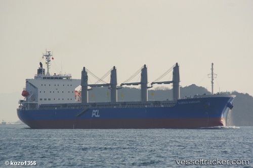
Vessel profile: EKATERINA is a Bulk Carrier with dimensions m x m.
This page combines live AIS, route history, probable destination signals, nearby traffic, and port activity for practical vessel monitoring.
The current position of vessel EKATERINA is -23.66593 lat / -42.98043 lng. Updated: 2026-05-20 02:09:55 UTCNearest reference points:
- 27 nm SW of Santos Dumont Apt/Rio de Janeiro
- Near Santos Dumont Apt/Rio de Janeiro
- 49 nm S of SEPETIBA
Currently sailing under the flag of Panama ![]()
Details:
Live Vessel EKATERINA Analytics (details, animations, etc.)
Recent AIS points (UTC):
2026-05-19 22:57:15 UTC · -23.40792, -42.39572 · SOG 10.8 kn · COG 245°2026-05-19 23:51:06 UTC · -23.47772, -42.55594 · SOG 11.1 kn · COG 243°
2026-05-20 01:54:55 UTC · -23.64777, -42.93198 · SOG 11.5 kn · COG 247°
2026-05-20 02:09:55 UTC · -23.66593, -42.98043 · SOG 11.5 kn · COG 248°