 vesseltracker.com
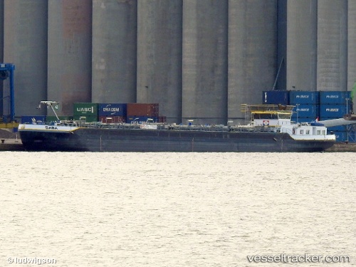
 Saba
Saba
Current Status
Where is the vessel?
Saba is currently in Near Hansweert/Schore, based on AIS data received less than 1h ago.
Latest AIS update:
Current position: 51.45385° N, 4.01129° E (Near Hansweert/Schore)
Average speed (last 7 days): Loading…
Average speed (last 30 days): Loading…
Vessel profile: Saba is a Chemical Oil Products Tanker with dimensions 86m x 10m.
This page combines live AIS, route history, probable destination signals, nearby traffic, and port activity for practical vessel monitoring.
The current position of vessel Saba is 51.45385 lat / 4.01129 lng. Updated: 2026-05-13 14:17:07 UTCNearest reference points:
- Near Hansweert/Schore
- Near S Heer Arendskerke
- Near YERSEKE
Currently sailing under the flag of Netherlands ![]()
Details:
Live Vessel Saba Analytics (details, animations, etc.)
Recent AIS points (UTC):
2026-05-13 10:37:32 UTC · 51.21890, 3.80296 · SOG 0 kn · COG -1°2026-05-13 11:59:19 UTC · 51.32603, 3.82361 · SOG 4.4 kn · COG -1°
2026-05-13 13:42:41 UTC · 51.41060, 3.96322 · SOG 7.9 kn · COG -1°
2026-05-13 14:17:07 UTC · 51.45385, 4.01129 · SOG 1.7 kn · COG -1°