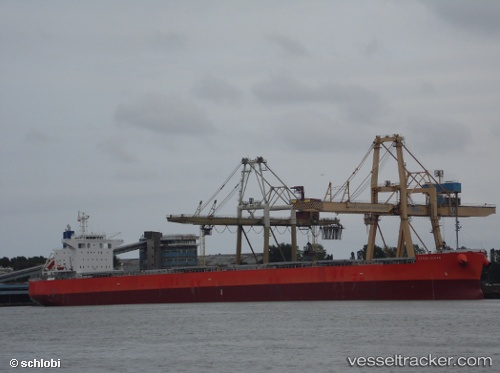
.
Vessel photo of Cetus Ocean (IMO 9643154) vesseltracker.com

PA flag Cetus Ocean

Vessel type: Bulk Carrier | IMO: 9643154 | MMSI: MMSI: 374366000
Call sign: 3EIA8 | Dimensions: 229 m x 229 m
Current Status

Where is the vessel?

Cetus Ocean is currently in Near WAILINGDING ISLAND, based on AIS data received about 14h ago.

Latest AIS update:

Current position: 21.97779° N, 113.95124° E (Near WAILINGDING ISLAND)

Average speed (last 7 days): Loading…

Average speed (last 30 days): Loading…

Vessel profile: Cetus Ocean is a Bulk Carrier with dimensions 229m x 229m.

This page combines live AIS, route history, probable destination signals, nearby traffic, and port activity for practical vessel monitoring.

The current position of vessel Cetus Ocean is 21.97779 lat / 113.95124 lng. Updated: 2026-05-18 00:07:55 UTC
More recent position available: 51 min ago

Shipinfo shows free vessel positions with a delay. After payment, you will be able to view the current position of this vessel for 24 hours.

We recommend registering. If you register, paid vessel access will be saved in your profile. Guest access works only through a personal link.

Nearest reference points:
  • Near WAILINGDING ISLAND
  • 15 nm S of WAILINGDING ISLAND
  • Near GUISHAN

Currently sailing under the flag of Panama PA flag

Cetus Ocean built in 2013 year

Deadweight:
82986 t

Details:

Live Vessel Cetus Ocean Analytics (details, animations, etc.)


Recent AIS points (UTC):
2026-05-17 19:46:54 UTC · 21.97767, 113.95118 · SOG 0.3 kn · COG 87°
2026-05-17 22:04:54 UTC · 21.97778, 113.95118 · SOG 0 kn · COG 96°
2026-05-17 22:10:54 UTC · 21.97757, 113.95124 · SOG 0.2 kn · COG 93°
2026-05-18 00:07:55 UTC · 21.97779, 113.95124 · SOG 0.1 kn · COG 99°

UTC: --
Start: -- Track timeline (UTC) End: --
Encountered: --


Link to the map:


Find another ship

Cetus_Ocean (374366000) last ports (portcalls and passsages)

GLADSTONE | 2025-08-23 05:36:35
Kobe | 2025-07-28 09:58:57
KADA | 2025-07-28 07:14:45
Newcastle | 2025-07-12 10:20:36
SUMOTO | 2025-06-06 12:23:13
Amagasaki | 2025-06-04 01:58:14
Kobe | 2025-06-04 00:00:46
HON GAI | 2025-05-10 14:12:03
Vung Tau | 2025-05-07 06:29:59
Cai Mep | 2025-05-05 09:37:35
Cai Mep | 2025-05-01 09:35:28
Gemalink | 2025-05-01 09:23:25
Vung Tau | 2025-05-01 08:15:45
Port Kembla | 2025-04-04 18:12:01
Xiamen | 2025-02-19 10:24:05
ZHANGZHOU | 2025-02-19 08:30:46
Newcastle | 2025-01-26 16:17:33
DUNG QUAT | 2025-01-01 20:58:44
Dung Quat Petroleum Port | 2024-12-30 08:18:41
DUNG QUAT | 2024-12-28 20:12:57
DUNG QUAT | 2024-12-24 19:04:11
Dung Quat Petroleum Port | 2024-12-24 17:17:30
GLADSTONE | 2024-12-05 12:51:37
TAKAHAMA | 2024-11-21 08:50:24
OKAMURA | 2024-11-21 07:21:20
Imabari | 2024-11-21 06:27:05
OKAMURA | 2024-11-16 01:21:09
Dung Quat Petroleum Port | 2024-10-23 04:02:42
Zamboanga | 2024-10-18 09:47:17
Gladstone Harbor | 2024-10-04 21:38:13
Thursday Island | 2024-09-25 12:36:49
Torres Strait | 2024-09-25 12:10:47
Thursday Island | 2024-08-09 07:18:53
Thursday Island | 2024-06-25 14:32:29
Torres Strait | 2024-06-25 13:42:11
Yampi Sound | 2024-05-27 11:04:08
Dung Quat Petroleum Port | 2024-04-15 00:25:32
Zamboanga | 2024-04-10 08:15:45
HITACHINAKA | 2024-03-11 22:00:26
Dung Quat Petroleum Port | 2024-01-28 22:23:24
Dung Quat Petroleum Port | 2024-01-24 22:21:25
Cairns Harbor | 2023-12-14 05:46:59
Dung Quat Petroleum Port | 2023-11-24 19:32:08
Dung Quat Petroleum Port | 2023-11-20 03:40:05
Gladstone Harbor | 2023-11-03 22:08:21
Thursday Island | 2023-10-27 12:24:34
Newcastle | 2023-07-31 14:16:16
Tatibana Ko | 2023-07-02 23:14:25
Zamboanga | 2023-04-13 10:56:28
Port Kembla | 2023-03-27 01:31:46
Kobe | 2023-02-14 09:12:19
Kobe | 2023-02-10 08:44:48
Gladstone Harbor | 2022-08-26 22:08:59
Thursday Island | 2022-08-20 07:34:38
Port Darwin | 2022-07-29 04:49:48
Port Darwin | 2022-07-25 04:45:52
Gladstone Harbor | 2022-06-13 07:23:44
Gladstone Harbor | 2022-03-27 06:00:00
Torres Strait | 2022-03-16 09:58:33
Gladstone Harbor | 2022-02-10 06:45:13
Torres Strait | 2022-02-01 08:06:23
Gladstone Harbor | 2021-12-27 12:56:21