 vesseltracker.com
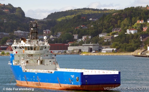
 FALCON TIDE
Current Status
Where is the vessel?
FALCON TIDE is currently in 12 nm NW of Thistle Field, based on AIS data received about 14h ago.
Latest AIS update:
Current position: 61.62667° N, 1.26500° E (12 nm NW of Thistle Field)
Average speed (last 7 days): Loading…
Average speed (last 30 days): Loading…
Vessel profile: FALCON TIDE is a Offshore Supply Ship with dimensions m x m.
This page combines live AIS, route history, probable destination signals, nearby traffic, and port activity for practical vessel monitoring.
The current position of vessel FALCON TIDE is 61.62667 lat / 1.26500 lng. Updated: 2026-05-18 14:12:38 UTCNearest reference points:
- 10 nm N of Leadon
Currently sailing under the flag of United Kingdom ![]()
Details:
Live Vessel FALCON TIDE Analytics (details, animations, etc.)
Recent AIS points (UTC):
2026-05-18 09:59:59 UTC · 61.64333, 1.29667 · SOG 1 kn · COG -1°2026-05-18 11:45:16 UTC · 61.63167, 1.26500 · SOG 3 kn · COG -1°
2026-05-18 13:30:30 UTC · 61.63167, 1.27167 · SOG 0 kn · COG -1°
2026-05-18 14:12:38 UTC · 61.62667, 1.26500 · SOG 10 kn · COG -1°