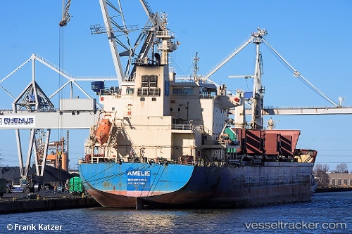
 Amelie
Current Status
Where is the vessel?
Amelie is currently in 15 nm SW of Thorntonbank, based on AIS data received about 14h ago.
Latest AIS update:
Current position: 51.43684° N, 2.65261° E (15 nm SW of Thorntonbank)
Average speed (last 7 days): Loading…
Average speed (last 30 days): Loading…
Vessel profile: Amelie is a Bulk Carrier with dimensions 180m x 30m.
This page combines live AIS, route history, probable destination signals, nearby traffic, and port activity for practical vessel monitoring.
The current position of vessel Amelie is 51.43684 lat / 2.65261 lng. Updated: 2026-05-21 19:51:38 UTCNearest reference points:
- 13 nm NW of Middelkerke
- Near Oostende
- Near Lombardsijde
Currently sailing under the flag of Liberia ![]()
Amelie built in 2013 year
Deadweight:
35000 tDetails:
Live Vessel Amelie Analytics (details, animations, etc.)
Recent AIS points (UTC):
2026-05-21 15:57:38 UTC · 51.43659, 2.65507 · SOG 0.1 kn · COG 217°2026-05-21 17:06:38 UTC · 51.43664, 2.65518 · SOG 0 kn · COG 219°
2026-05-21 18:03:41 UTC · 51.43667, 2.65510 · SOG 0.1 kn · COG 223°
2026-05-21 19:51:38 UTC · 51.43684, 2.65261 · SOG 0.2 kn · COG 163°