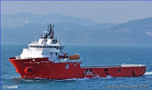
 PACIFIC LIBERTY
Current Status
Where is the vessel?
PACIFIC LIBERTY is currently in Near LABUAN, based on AIS data received about 15h ago.
Latest AIS update:
Current position: 5.25979° N, 115.26078° E (Near LABUAN)
Average speed (last 7 days): Loading…
Average speed (last 30 days): Loading…
Vessel profile: PACIFIC LIBERTY is a Other Type with dimensions m x m.
This page combines live AIS, route history, probable destination signals, nearby traffic, and port activity for practical vessel monitoring.
The current position of vessel PACIFIC LIBERTY is 5.25979 lat / 115.26078 lng. Updated: 2026-05-18 22:24:54 UTCNearest reference points:
- 44 nm SW of Tembungo
- Near Kikeh
- Near Kota Kinabalu
Currently sailing under the flag of United Kingdom ![]()
Details:
Live Vessel PACIFIC LIBERTY Analytics (details, animations, etc.)
Recent AIS points (UTC):
2026-05-18 19:48:58 UTC · 5.25966, 115.26086 · SOG 0.1 kn · COG 58°2026-05-18 19:51:56 UTC · 5.25964, 115.26085 · SOG 0 kn · COG 62°
2026-05-18 22:00:54 UTC · 5.26004, 115.26072 · SOG 0 kn · COG 99°
2026-05-18 22:24:54 UTC · 5.25979, 115.26078 · SOG 0 kn · COG 71°