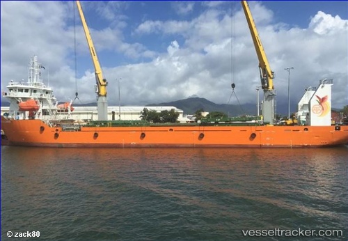
Fly Alliance
Current StatusWhere is the vessel?
Fly Alliance is currently in 57 nm SW of Kumul, based on AIS data received about 14h ago.
Latest AIS update:
Current position: 8.68500° S, 143.81833° E (57 nm SW of Kumul)
Average speed (last 7 days): Loading…
Average speed (last 30 days): Loading…
Vessel profile: Fly Alliance is a Container Ship with dimensions 19m x 91m.
This page combines live AIS, route history, probable destination signals, nearby traffic, and port activity for practical vessel monitoring.
The current position of vessel Fly Alliance is -8.68500 lat / 143.81833 lng. Updated: 2026-05-19 04:37:19 UTCNearest reference points:
- 46 nm NW of Kopi
- Near Thursday Island
- Near Torres Strait
Details:
Live Vessel Fly Alliance Analytics (details, animations, etc.)
Recent AIS points (UTC):
2026-05-19 02:01:51 UTC · -8.54025, 143.51878 · SOG 5.9 kn · COG 132°2026-05-19 02:13:13 UTC · -8.55333, 143.53168 · SOG 6 kn · COG -1°
2026-05-19 03:43:14 UTC · -8.64667, 143.69167 · SOG 8 kn · COG -1°
2026-05-19 04:37:19 UTC · -8.68500, 143.81833 · SOG 9 kn · COG -1°