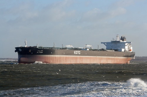
 Al Kout
Current Status
Where is the vessel?
Al Kout is currently in 17 nm NW of Umm al Quwain, based on AIS data received about 34d ago.
Latest AIS update:
Current position: 25.77333° N, 55.35330° E (17 nm NW of Umm al Quwain)
Average speed (last 7 days): Loading…
Average speed (last 30 days): Loading…
Vessel profile: Al Kout is a Crude Oil Tanker with dimensions 333m x 333m.
This page combines live AIS, route history, probable destination signals, nearby traffic, and port activity for practical vessel monitoring.
The current position of vessel Al Kout is 25.77333 lat / 55.35330 lng. Updated: 2026-04-18 06:12:36 UTCNearest reference points:
- Near AJMAN
- Near Sharjah
- Near Al Hamriyah
Currently sailing under the flag of Kuwait ![]()
Details:
Live Vessel Al Kout Analytics (details, animations, etc.)
Recent AIS points (UTC):
2026-04-18 03:57:42 UTC · 25.68283, 54.92057 · SOG 11.2 kn · COG 79°2026-04-18 05:39:32 UTC · 25.75115, 55.25537 · SOG 11.3 kn · COG 68°
2026-04-18 06:12:36 UTC · 25.77333, 55.35330 · SOG 10.5 kn · COG -1°
2026-04-18 06:12:36 UTC · 25.77333, 55.35330 · SOG 10.5 kn · COG -1°