 BESIKTAS GH
Current Status
Where is the vessel?
BESIKTAS GH is currently in 21 nm SW of Piriápolis, based on AIS data received about 14h ago.
Latest AIS update:
Current position: 35.06502° S, 55.61278° W (21 nm SW of Piriápolis)
Average speed (last 7 days): Loading…
Average speed (last 30 days): Loading…
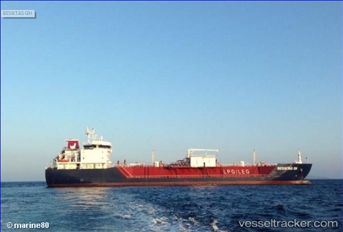
Vessel profile: BESIKTAS GH is a LPG Tanker with dimensions 19m x 123m.
This page combines live AIS, route history, probable destination signals, nearby traffic, and port activity for practical vessel monitoring.
The current position of vessel BESIKTAS GH is -35.06502 lat / -55.61278 lng. Updated: 2026-05-20 22:12:53 UTCNearest reference points:
- 12 nm S of Piriápolis
- 21 nm E of PUNTA DEL ESTE
- 16 nm N of Cabo San Antonio
Currently sailing under the flag of Marshall Islands ![]()
BESIKTAS GH built in 2013 year
Deadweight:
9212 tDetails:
Live Vessel BESIKTAS GH Analytics (details, animations, etc.)
Recent AIS points (UTC):
2026-05-20 16:31:22 UTC · -35.16006, -57.00592 · SOG 13.4 kn · COG 113°2026-05-20 17:46:28 UTC · -35.16833, -56.67167 · SOG 13 kn · COG -1°
2026-05-20 19:33:57 UTC · -35.12713, -56.21042 · SOG 13.4 kn · COG 48°
2026-05-20 22:12:53 UTC · -35.06502, -55.61278 · SOG 11.6 kn · COG 146°