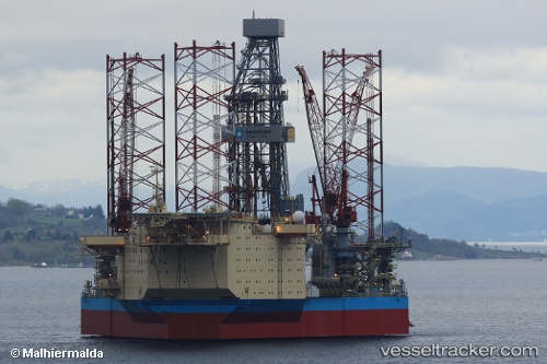
 NOBLE INTEGRATOR
Current Status
Where is the vessel?
NOBLE INTEGRATOR is currently in 15 nm NE of Vilje, based on AIS data received about 15h ago.
Latest AIS update:
Current position: 59.87148° N, 2.56765° E (15 nm NE of Vilje)
Average speed (last 7 days): Loading…
Average speed (last 30 days): Loading…
Vessel profile: NOBLE INTEGRATOR is a Not available with dimensions m x m.
This page combines live AIS, route history, probable destination signals, nearby traffic, and port activity for practical vessel monitoring.
The current position of vessel NOBLE INTEGRATOR is 59.87148 lat / 2.56765 lng. Updated: 2026-05-19 08:03:18 UTCNearest reference points:
- 10 nm N of Leadon
- Near Alba Oil Field
- Near Solund
Currently sailing under the flag of Marshall Islands ![]()
Details:
Live Vessel NOBLE INTEGRATOR Analytics (details, animations, etc.)
Recent AIS points (UTC):
2026-05-19 04:12:18 UTC · 59.87146, 2.56771 · SOG 0 kn · COG 69°2026-05-19 06:00:04 UTC · 59.87141, 2.56750 · SOG 0 kn · COG 68°
2026-05-19 07:51:17 UTC · 59.87144, 2.56770 · SOG 0 kn · COG 69°
2026-05-19 08:03:18 UTC · 59.87148, 2.56765 · SOG 0 kn · COG 68°