 SENTINEL
Current Status
Where is the vessel?
SENTINEL is currently in 48 nm SW of Sámara, based on AIS data received about 14h ago.
Latest AIS update:
Current position: 9.25410° N, 86.03593° W (48 nm SW of Sámara)
Average speed (last 7 days): Loading…
Average speed (last 30 days): Loading…
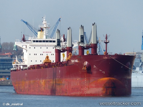
Vessel profile: SENTINEL is a Bulk Carrier with dimensions m x m.
This page combines live AIS, route history, probable destination signals, nearby traffic, and port activity for practical vessel monitoring.
The current position of vessel SENTINEL is 9.25410 lat / -86.03593 lng. Updated: 2026-05-23 06:28:17 UTCNearest reference points:
- 67 nm SW of Sámara
- 27 nm W of Playa Conchal
- Near Golfo de Papagayo
Currently sailing under the flag of Portugal ![]()
Details:
Live Vessel SENTINEL Analytics (details, animations, etc.)
Recent AIS points (UTC):
2026-05-23 02:43:09 UTC · 9.61630, -86.58978 · SOG 10.3 kn · COG 130°2026-05-23 03:25:42 UTC · 9.55010, -86.48583 · SOG 10.4 kn · COG 128°
2026-05-23 04:17:49 UTC · 9.46520, -86.35890 · SOG 10.4 kn · COG 125°
2026-05-23 06:28:17 UTC · 9.25410, -86.03593 · SOG 10.4 kn · COG 127°