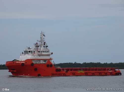
 TOPAZ AMANI
Current Status
Where is the vessel?
TOPAZ AMANI is currently in 47 nm E of MOCIMBOA DA PRAIA, based on AIS data received about 14h ago.
Latest AIS update:
Current position: 11.23323° S, 41.15434° E (47 nm E of MOCIMBOA DA PRAIA)
Average speed (last 7 days): Loading…
Average speed (last 30 days): Loading…
Vessel profile: TOPAZ AMANI is a Offshore Supply Ship with dimensions 17m x 75m.
This page combines live AIS, route history, probable destination signals, nearby traffic, and port activity for practical vessel monitoring.
The current position of vessel TOPAZ AMANI is -11.23323 lat / 41.15434 lng. Updated: 2026-05-21 07:40:12 UTCNearest reference points:
- Near Mtwara
- 64 nm NE of Mtwara
- 47 nm NW of Mohéli Apt
Currently sailing under the flag of Marshall Islands ![]()
TOPAZ AMANI built in 2013 year
Deadweight:
3130 tDetails:
Live Vessel TOPAZ AMANI Analytics (details, animations, etc.)
Recent AIS points (UTC):
2026-05-21 04:10:16 UTC · -11.17567, 41.11543 · SOG 2.3 kn · COG 154°2026-05-21 05:59:19 UTC · -11.19328, 41.13588 · SOG 4.2 kn · COG 143°
2026-05-21 07:32:30 UTC · -11.22979, 41.15280 · SOG 1.8 kn · COG 156°
2026-05-21 07:40:12 UTC · -11.23323, 41.15434 · SOG 1.9 kn · COG 156°