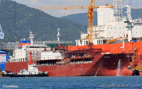
 Taugas
Current Status
Where is the vessel?
Taugas is currently in 22 nm SE of Selsey, based on AIS data received about 14h ago.
Latest AIS update:
Current position: 50.40688° N, 0.51260° W (22 nm SE of Selsey)
Average speed (last 7 days): Loading…
Average speed (last 30 days): Loading…
Vessel profile: Taugas is a Lpg Tanker with dimensions 146m x 23m.
This page combines live AIS, route history, probable destination signals, nearby traffic, and port activity for practical vessel monitoring.
The current position of vessel Taugas is 50.40688 lat / -0.51260 lng. Updated: 2026-05-21 17:04:02 UTCNearest reference points:
- 23 nm S of Ferring
- 15 nm S of Selsey
- 27 nm S of Seaford
Currently sailing under the flag of Antigua Barbuda ![]()
Details:
Live Vessel Taugas Analytics (details, animations, etc.)
Recent AIS points (UTC):
2026-05-21 13:39:27 UTC · 50.59358, 0.53823 · SOG 10.5 kn · COG 253°2026-05-21 14:05:56 UTC · 50.57225, 0.41749 · SOG 11.1 kn · COG 261°
2026-05-21 16:25:37 UTC · 50.44995, -0.29325 · SOG 13.3 kn · COG 260°
2026-05-21 17:04:02 UTC · 50.40688, -0.51260 · SOG 14.2 kn · COG 257°