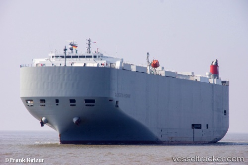
 Galveston Highway
Current Status
Where is the vessel?
Galveston Highway is currently in Near Talleyrand, based on AIS data received about 14h ago.
Latest AIS update:
Current position: 30.34463° N, 81.62190° W (Near Talleyrand)
Average speed (last 7 days): Loading…
Average speed (last 30 days): Loading…
Vessel profile: Galveston Highway is a Vehicles Carrier with dimensions 199m x 32m.
This page combines live AIS, route history, probable destination signals, nearby traffic, and port activity for practical vessel monitoring.
The current position of vessel Galveston Highway is 30.34463 lat / -81.62190 lng. Updated: 2026-05-19 06:18:33 UTCNearest reference points:
- Near Jacksonville
- Near Ponte Vedra
- Near Fernandina
Currently sailing under the flag of Panama ![]()
Details:
Live Vessel Galveston Highway Analytics (details, animations, etc.)
Recent AIS points (UTC):
2026-05-19 02:19:56 UTC · 30.39538, -81.35166 · SOG 10.9 kn · COG 287°2026-05-19 04:24:35 UTC · 30.34582, -81.62092 · SOG 1.6 kn · COG 201°
2026-05-19 04:36:56 UTC · 30.34460, -81.62190 · SOG 0.1 kn · COG 190°
2026-05-19 06:18:33 UTC · 30.34463, -81.62190 · SOG 0 kn · COG 190°