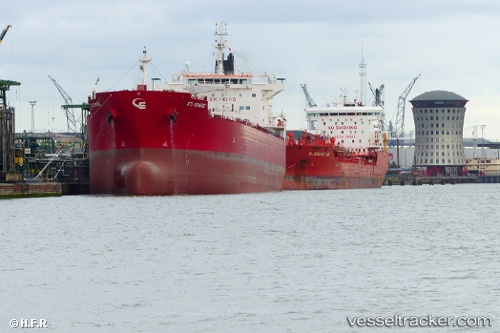
 TORM DUBAI
Current Status
Where is the vessel?
TORM DUBAI is currently in 67 nm N of Isla Grande, based on AIS data received about 15h ago.
Latest AIS update:
Current position: 10.71983° N, 79.85873° W (67 nm N of Isla Grande)
Average speed (last 7 days): Loading…
Average speed (last 30 days): Loading…
Vessel profile: TORM DUBAI is a Tanker with dimensions m x m.
This page combines live AIS, route history, probable destination signals, nearby traffic, and port activity for practical vessel monitoring.
The current position of vessel TORM DUBAI is 10.71983 lat / -79.85873 lng. Updated: 2026-05-18 20:18:56 UTCNearest reference points:
- Near Colon
- Near COLON 2000
- Near Colón Free Zone
Currently sailing under the flag of Singapore ![]()
Details:
Live Vessel TORM DUBAI Analytics (details, animations, etc.)
Recent AIS points (UTC):
2026-05-18 17:35:53 UTC · 10.16568, -79.92001 · SOG 12.6 kn · COG -1°2026-05-18 19:33:49 UTC · 10.57404, -79.87456 · SOG 11.8 kn · COG -1°
2026-05-18 19:48:51 UTC · 10.62368, -79.86907 · SOG 11.9 kn · COG -1°
2026-05-18 20:18:56 UTC · 10.71983, -79.85873 · SOG 11.8 kn · COG -1°