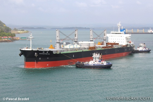
Navigation Ol
Current StatusWhere is the vessel?
Navigation Ol is currently in 295 nm NW of Bajo Grande, based on AIS data received about 14h ago.
Latest AIS update:
Current position: 13.70746° N, 175.40341° W (295 nm NW of Bajo Grande)
Average speed (last 7 days): Loading…
Average speed (last 30 days): Loading…
Vessel profile: Navigation Ol is a Bulk Carrier with dimensions 32m x 199m.
This page combines live AIS, route history, probable destination signals, nearby traffic, and port activity for practical vessel monitoring.
The current position of vessel Navigation Ol is 13.70746 lat / -175.40341 lng. Updated: 2026-05-20 23:37:06 UTCNearest reference points:
- Open sea, approx. 400 nm off the nearest listed port
- Open sea, approx. 402 nm off the nearest listed port
- Open sea, approx. 406 nm off the nearest listed port
Details:
Live Vessel Navigation Ol Analytics (details, animations, etc.)
Recent AIS points (UTC):
2026-05-20 17:27:16 UTC · 13.58865, -174.30016 · SOG 10.4 kn · COG 277°2026-05-20 22:10:17 UTC · 13.68121, -175.14531 · SOG 10.6 kn · COG 276°
2026-05-20 22:29:22 UTC · 13.68500, -175.20166 · SOG 10 kn · COG -1°
2026-05-20 23:37:06 UTC · 13.70746, -175.40341 · SOG 10.4 kn · COG 277°