 vesseltracker.com
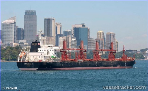
 AFRICAN LAPWING
Current Status
Where is the vessel?
AFRICAN LAPWING is currently in 323 nm S of Tsuzuki Ku, based on AIS data received about 15h ago.
Latest AIS update:
Current position: 30.35867° N, 141.29987° W (323 nm S of Tsuzuki Ku)
Average speed (last 7 days): Loading…
Average speed (last 30 days): Loading…
Vessel profile: AFRICAN LAPWING is a Cargo with dimensions m x m.
This page combines live AIS, route history, probable destination signals, nearby traffic, and port activity for practical vessel monitoring.
The current position of vessel AFRICAN LAPWING is 30.35867 lat / -141.29987 lng. Updated: 2026-05-18 07:22:53 UTCNearest reference points:
- Open sea, approx. 401 nm off the nearest listed port
- Open sea, approx. 400 nm off the nearest listed port
- Open sea, approx. 405 nm off the nearest listed port
Currently sailing under the flag of Bahamas ![]()
Details:
Live Vessel AFRICAN LAPWING Analytics (details, animations, etc.)
Recent AIS points (UTC):
2026-05-18 04:31:42 UTC · 30.22007, -140.65053 · SOG 11.9 kn · COG 281°2026-05-18 05:19:23 UTC · 30.25903, -140.82806 · SOG 12.1 kn · COG 286°
2026-05-18 07:19:31 UTC · 30.35592, -141.28706 · SOG 12.1 kn · COG 283°
2026-05-18 07:22:53 UTC · 30.35867, -141.29987 · SOG 12.2 kn · COG 284°