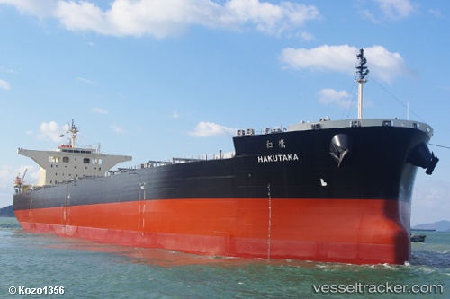
 Hakutaka
Current Status
Where is the vessel?
Hakutaka is currently in 23 nm NE of Kashima Ko, based on AIS data received about 14h ago.
Latest AIS update:
Current position: 36.24300° N, 141.06299° E (23 nm NE of Kashima Ko)
Average speed (last 7 days): Loading…
Average speed (last 30 days): Loading…
Vessel profile: Hakutaka is a Bulk Carrier with dimensions 235m x 235m.
This page combines live AIS, route history, probable destination signals, nearby traffic, and port activity for practical vessel monitoring.
The current position of vessel Hakutaka is 36.24300 lat / 141.06299 lng. Updated: 2026-05-22 06:08:58 UTCNearest reference points:
- 12 nm E of CHOSHI
- Near Mito
- Near KASHIMA
Currently sailing under the flag of Liberia ![]()
Details:
Live Vessel Hakutaka Analytics (details, animations, etc.)
Recent AIS points (UTC):
2026-05-22 01:41:42 UTC · 36.39095, 141.16196 · SOG 1.2 kn · COG -1°2026-05-22 03:57:37 UTC · 36.31890, 141.12317 · SOG 2.8 kn · COG 112°
2026-05-22 04:08:16 UTC · 36.31298, 141.11885 · SOG 2.2 kn · COG 118°
2026-05-22 06:08:58 UTC · 36.24300, 141.06299 · SOG 3.5 kn · COG 126°