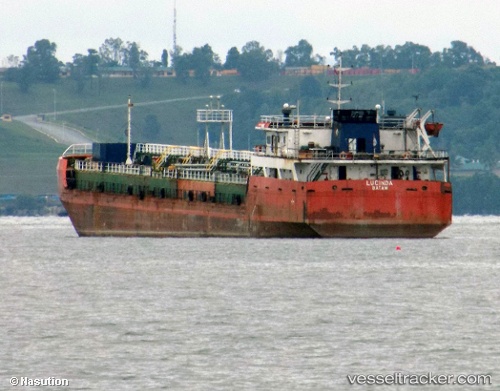
 Mt Lucinda
Current Status
Where is the vessel?
Mt Lucinda is currently in 51 nm NW of TANJUNG JATI, based on AIS data received about 14h ago.
Latest AIS update:
Current position: 5.69833° S, 110.30333° E (51 nm NW of TANJUNG JATI)
Average speed (last 7 days): Loading…
Average speed (last 30 days): Loading…
Vessel profile: Mt Lucinda is a Oil Products Tanker with dimensions 88m x 16m.
This page combines live AIS, route history, probable destination signals, nearby traffic, and port activity for practical vessel monitoring.
The current position of vessel Mt Lucinda is -5.69833 lat / 110.30333 lng. Updated: 2026-05-21 17:46:56 UTCNearest reference points:
- 49 nm NE of TANJUNG JATI
- Near Batang
- 26 nm N of Pemalang
Currently sailing under the flag of Indonesia ![]()
Details:
Live Vessel Mt Lucinda Analytics (details, animations, etc.)
Recent AIS points (UTC):
2026-05-21 13:48:13 UTC · -5.69667, 110.04667 · SOG 4 kn · COG -1°2026-05-21 16:05:28 UTC · -5.69667, 110.19167 · SOG 4 kn · COG -1°
2026-05-21 16:05:28 UTC · -5.69667, 110.19167 · SOG 4 kn · COG -1°
2026-05-21 17:46:56 UTC · -5.69833, 110.30333 · SOG 4 kn · COG -1°