 Lunita
Current Status
Where is the vessel?
Lunita is currently in 49 nm SE of Pointe d’Esny, based on AIS data received about 14h ago.
Latest AIS update:
Current position: 21.14500° S, 58.12167° E (49 nm SE of Pointe d’Esny)
Average speed (last 7 days): Loading…
Average speed (last 30 days): Loading…
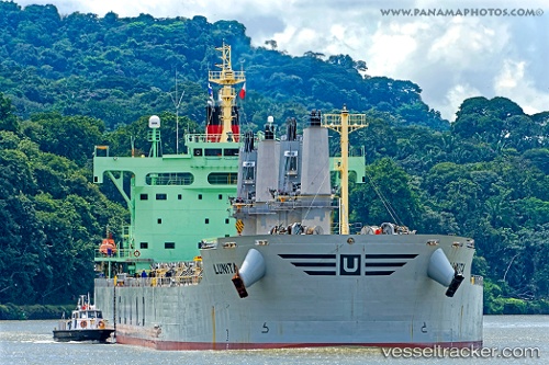
Vessel profile: Lunita is a Bulk Carrier with dimensions 190m x 32m.
This page combines live AIS, route history, probable destination signals, nearby traffic, and port activity for practical vessel monitoring.
The current position of vessel Lunita is -21.14500 lat / 58.12167 lng. Updated: 2026-05-22 19:26:35 UTCNearest reference points:
- Near Port Louis
- 61 nm NW of Al Azaiba
- 159 nm W of Rodrigues
Currently sailing under the flag of Norway ![]()
Details:
Live Vessel Lunita Analytics (details, animations, etc.)
Recent AIS points (UTC):
2026-05-22 16:58:34 UTC · -21.38484, 57.69743 · SOG 11.3 kn · COG 60°2026-05-22 18:19:45 UTC · -21.27689, 57.94471 · SOG 11.6 kn · COG -1°
2026-05-22 19:02:32 UTC · -21.19167, 58.05833 · SOG 11 kn · COG -1°
2026-05-22 19:26:35 UTC · -21.14500, 58.12167 · SOG 10 kn · COG -1°