 vesseltracker.com
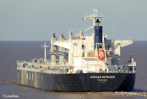
 AFRICAN BATELEUR
Current Status
Where is the vessel?
AFRICAN BATELEUR is currently in 262 nm SW of Pulau Nias, based on AIS data received about 16h ago.
Latest AIS update:
Current position: 1.67481° S, 94.15760° E (262 nm SW of Pulau Nias)
Average speed (last 7 days): Loading…
Average speed (last 30 days): Loading…
Vessel profile: AFRICAN BATELEUR is a Cargo with dimensions m x m.
This page combines live AIS, route history, probable destination signals, nearby traffic, and port activity for practical vessel monitoring.
The current position of vessel AFRICAN BATELEUR is -1.67481 lat / 94.15760 lng. Updated: 2026-05-18 07:16:32 UTCNearest reference points:
- Open sea, approx. 403 nm off the nearest listed port
- Open sea, approx. 402 nm off the nearest listed port
- Open sea, approx. 414 nm off the nearest listed port
Currently sailing under the flag of Bahamas ![]()
Details:
Live Vessel AFRICAN BATELEUR Analytics (details, animations, etc.)
Recent AIS points (UTC):
2026-05-18 07:16:32 UTC · -1.67481, 94.15760 · SOG 11.8 kn · COG 302°2026-05-18 07:16:32 UTC · -1.67481, 94.15760 · SOG 11.8 kn · COG 302°
2026-05-18 07:16:32 UTC · -1.67481, 94.15760 · SOG 11.8 kn · COG 302°
2026-05-18 07:16:32 UTC · -1.67481, 94.15760 · SOG 11.8 kn · COG 302°