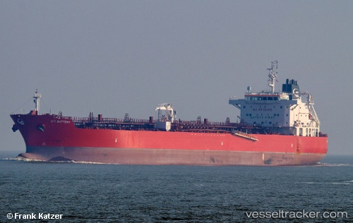
 TORM DOVER
Current Status
Where is the vessel?
TORM DOVER is currently in 41 nm S of Kukdo, based on AIS data received about 15h ago.
Latest AIS update:
Current position: 33.86283° N, 128.29904° E (41 nm S of Kukdo)
Average speed (last 7 days): Loading…
Average speed (last 30 days): Loading…
Vessel profile: TORM DOVER is a Tanker with dimensions m x m.
This page combines live AIS, route history, probable destination signals, nearby traffic, and port activity for practical vessel monitoring.
The current position of vessel TORM DOVER is 33.86283 lat / 128.29904 lng. Updated: 2026-05-19 08:10:58 UTCNearest reference points:
- 25 nm S of Kukdo
- 35 nm E of Geomundo
- 33 nm W of IZUHARA
Currently sailing under the flag of Denmark ![]()
Details:
Live Vessel TORM DOVER Analytics (details, animations, etc.)
Recent AIS points (UTC):
2026-05-19 05:02:06 UTC · 33.85280, 128.26819 · SOG 0.5 kn · COG 255°2026-05-19 06:08:05 UTC · 33.85521, 128.27393 · SOG 0.6 kn · COG 234°
2026-05-19 07:06:26 UTC · 33.85833, 128.28667 · SOG 0 kn · COG -1°
2026-05-19 08:10:58 UTC · 33.86283, 128.29904 · SOG 0.3 kn · COG 186°