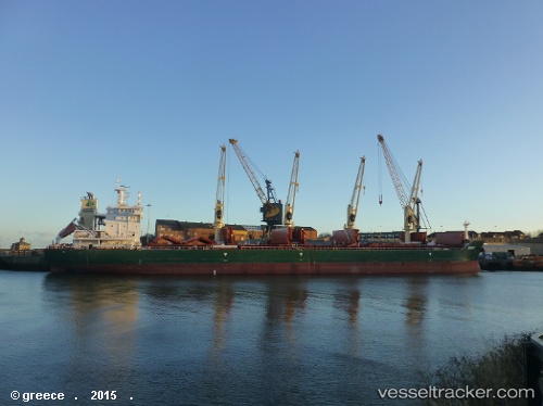
 MUSKY
MUSKY
Current Status
Where is the vessel?
MUSKY is currently in 39 nm NW of West End, based on AIS data received about 14h ago.
Latest AIS update:
Current position: 27.22539° N, 79.36911° W (39 nm NW of West End)
Average speed (last 7 days): Loading…
Average speed (last 30 days): Loading…
Vessel profile: MUSKY is a Cargo with dimensions m x m.
This page combines live AIS, route history, probable destination signals, nearby traffic, and port activity for practical vessel monitoring.
The current position of vessel MUSKY is 27.22539 lat / -79.36911 lng. Updated: 2026-06-08 16:39:00 UTCNearest reference points:
- Near Juno Beach
- Near North Palm Beach
- Near Lake Park
Currently sailing under the flag of Marshall Islands ![]()
Details:
Live Vessel MUSKY Analytics (details, animations, etc.)
Recent AIS points (UTC):
2026-06-08 13:14:48 UTC · 26.46333, -79.45500 · SOG 13 kn · COG -1°2026-06-08 13:28:43 UTC · 26.51703, -79.45191 · SOG 13.6 kn · COG -1°
2026-06-08 16:16:29 UTC · 27.14816, -79.40073 · SOG 13.3 kn · COG -1°
2026-06-08 16:39:00 UTC · 27.22539, -79.36911 · SOG 13.1 kn · COG -1°