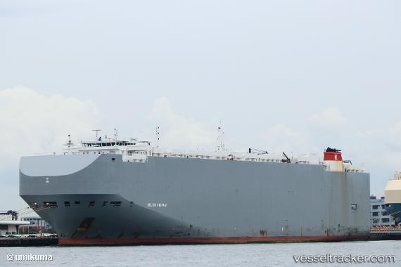
Helios Highway
Current StatusWhere is the vessel?
Helios Highway is currently in 329 nm NE of Levelwood, based on AIS data received about 14h ago.
Latest AIS update:
Current position: 11.11638° S, 1.86790° W (329 nm NE of Levelwood)
Average speed (last 7 days): Loading…
Average speed (last 30 days): Loading…
Vessel profile: Helios Highway is a Vehicles Carrier with dimensions 36m x 200m.
This page combines live AIS, route history, probable destination signals, nearby traffic, and port activity for practical vessel monitoring.
The current position of vessel Helios Highway is -11.11638 lat / -1.86790 lng. Updated: 2026-05-21 12:24:12 UTCNearest reference points:
- 347 nm NE of Levelwood
- Open sea, approx. 400 nm off the nearest listed port
- Open sea, approx. 401 nm off the nearest listed port
Details:
Live Vessel Helios Highway Analytics (details, animations, etc.)
Recent AIS points (UTC):
2026-05-21 07:56:43 UTC · -9.96181, -2.68579 · SOG 19 kn · COG 145°2026-05-21 10:04:27 UTC · -10.52333, -2.30333 · SOG 18 kn · COG -1°
2026-05-21 11:03:03 UTC · -10.77552, -2.12375 · SOG 18.4 kn · COG 141°
2026-05-21 12:24:12 UTC · -11.11638, -1.86790 · SOG 18.6 kn · COG 145°