 SEASTAR VIKING
Current Status
Where is the vessel?
SEASTAR VIKING is currently in Near Belle Chase, based on AIS data received about 16h ago.
Latest AIS update:
Current position: 29.81987° N, 90.00413° W (Near Belle Chase)
Average speed (last 7 days): Loading…
Average speed (last 30 days): Loading…
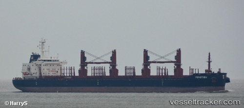
Vessel profile: SEASTAR VIKING is a Cargo with dimensions m x m.
This page combines live AIS, route history, probable destination signals, nearby traffic, and port activity for practical vessel monitoring.
The current position of vessel SEASTAR VIKING is 29.81987 lat / -90.00413 lng. Updated: 2026-05-19 10:04:23 UTCNearest reference points:
- Near Meraux
- Near Marrero
- Near Pointe a la Hache
Currently sailing under the flag of Gibraltar ![]()
Details:
Live Vessel SEASTAR VIKING Analytics (details, animations, etc.)
Recent AIS points (UTC):
2026-05-19 07:10:23 UTC · 29.81985, -90.00427 · SOG 0 kn · COG 29°2026-05-19 08:21:26 UTC · 29.81988, -90.00417 · SOG 0 kn · COG -1°
2026-05-19 09:28:37 UTC · 29.81990, -90.00427 · SOG 0 kn · COG 18°
2026-05-19 10:04:23 UTC · 29.81987, -90.00413 · SOG 0.1 kn · COG 4°